

iGeoTrans X Lite app for iPhone and iPad
Developer: TRAN TRUNG CHUYEN
First release : 13 Oct 2011
App size: 107.78 Mb
iGeoTrans X is a cloud app on the smartphone, designed to address common problems for fieldwork researchers hoping to use smartphones ad the field as GPS/GIS & Data collection devices.
___________________
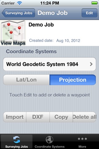
What can you do with iGeoTrans:
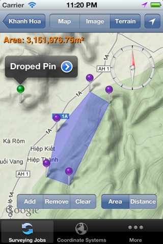
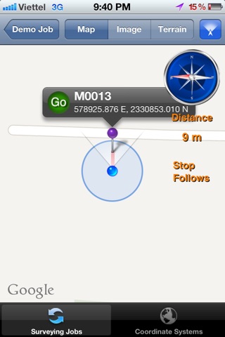
- Record the route from a specific location to the site surveys and display on the map.
- Measure the distance between two specific locations by coordinates or selected on the map.
- Measure the area of a region according to the coordinates list or selected on the map.
- Take the photo with GPS coordinates.
- Create Markers, Polyline, Polygon using GPS positioning, or import from coordinates file.
- Create the geographic object (Features) using Point, LineString, and Polygon with custom forms to enter attribute data.
- Synchronize data between different devices via your iCloud account.
- Export data in popular formats to share with other software.
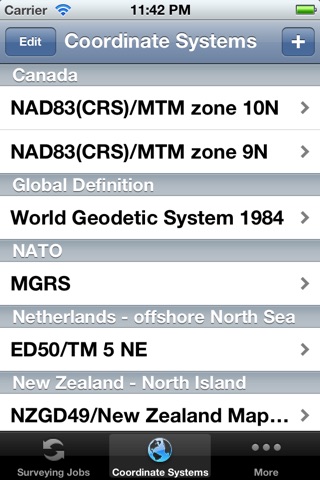
- Manage popular background map layers, allowing adding map overlays.
- Search by place, feature, and route.
- Manage site survey and customs forms.
- Manage advanced settings.
__________________________________
We love hearing from our users, and we hope you will be our friend on the Internet.
Facebook: https://www.facebook.com/iGeoTrans/
Website: https://geomatics.vn
Latest reviews of iGeoTrans X Lite app for iPhone and iPad
Fantastic app! Very useful for finding control monuments and staking out locations in various coordinate systems. Best app so far for a Land surveyor in my opinion.
Error Domain=kCLErrorDomain Code=1 "The operation couldn’t be completed. (kCLErrorDomain error 1.)"
Do not let one star fool you. Can not rate less than one star. Put in one point and it tells you to get the 49 buck version to add additional points?????
Program is good but unnecessarily expensive. Having customs projection is excellent. It should not be more expensive than a comprehensive navigation software. Still i find opening my laptop and convert coordinates an find it my navigation software. So unless i need it no desire to buy it. I would not buy it before desperatelly need it as good to have it.
Id like to take a photo when add point. Thanks